Mount Kinabalu, at 4,095m high, is one of the tallest mountains in Southeast Asia (there are a number of mountains in Myanmar and Indonesia’s West Papua which are higher than Kinabalu). It is one of the most accessible high mountains (above 3,000m) in the world. The starting points of the climbing trails, located near the park HQ area, are reachable via normal roads, and the summit can be scaled at a normal climbing pace in 2 days and 1 night, though top-conditioned climbers can climb to the top and back in less than four hours.
There are two main climbing routes: the Timpohon Trail (6 km in length) and the Mesilau Trail (8 km in length and more undulating). Both trails end at Laban Rata (3,314m asl), where climbers stay for one night before commencing the summit climb between 2–3am. From Laban Rata, the climb to the summit is 2.7 km. The aim is to reach the summit before 6am to see the sunrise. After reaching the summit, the majority of climbers will trek back to Laban Rata via the same route they came up and then back to the park HQ via either the Timpohon or Mesilau Trail. For the more adventurous, they can make the descent back to Laban Rata via Via Ferrata, which is a mountain route on the cliff side consisting of a series of rungs, rails and cables attached to the rock face.
Day 1 – Singapore to Kota Kinabalu
We visited Kota Kinabalu during the Chinese New Year period (btw, I’m a Chinese Singaporean). Our AirAsia flight (2 hrs 30 mins) reached Kota Kinabalu International Airport (KKIA) at around 8pm. We took a pre-paid taxi (RM40) to our hotel (Gaya Center Hotel) in the city centre, a 15-min drive from the airport. After checking in to the hotel, we patronised a nearby coffee shop for dinner and retired to the hotel for an early night.
“Kota Kinabalu International Airport is a pretty new airport, having been expanded and renovated. There are two terminals (Terminal 1 and Terminal 2), which together serve more than 19 airlines. It is the second busiest airport in Malaysia after Kuala Lumpur International Airport. There is a tourist information counter with staff inside, a pre-paid taxi booth selling vouchers for travel into the city centre, a left-luggage service and a booth selling local SIM cards. From my experience, it is always useful to have a local SIM card on hand to help save on calling charges, especially if you are staying for more than a few days.”
Day 2 – Park Headquarters to Laban Rata
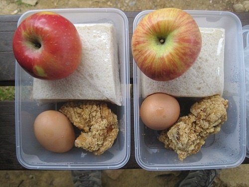
At 6am, we waited in the hotel lobby for the tour agency to pick us up for the headquarters of Mt K. As the hotel breakfast only started at 7am, we requested the hotel to prepare some simple takeaway breakfast for us. It turned out to be toast with jam and hard-boiled eggs. The minivan journey to Mt K took about two hours. We reached the headquarters at around 8.30am. The driver handed us over to our mountain guide, who then directed us to wait inside the climbers’ reception area, which had some sofas, while he completed the climbing registration on our behalf. “There is a left-luggage service at the climbers’ reception area where climbers can deposit their luggage (whatever you don’t need to bring up the mountain) for RM10 per piece. The headquarters also provides porter services, which are available at the time of request, i.e. there is no need to make a prior booking. The prevailing porter fee for a return trip is about RM8–9 per kg, with a minimum weight commitment of 10 kg.” The load will be weighed using a weighing machine in front of both the hirer and porter to verify the weight.
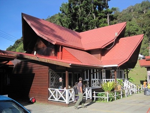
After depositing our main luggage, we were still left with 10 kg of stuff that we wanted to bring up the mountain, excluding our daypacks containing water, camera, valuables, poncho and medication, which we would carry ourselves. Don’t ask me why we carried so many things up the mountain =). We informed our guide that we needed to hire one porter to carry some of our stuff. To our surprise, he offered to be the porter himself and charged us RM9 per kg. I am not sure whether this is the usual practice among guides, but it did not seem appropriate to me as it deprived the actual porters of some business. We took a minivan to Timpohon Gate – the starting point of the trail – which is 4.5 km from the headquarters.
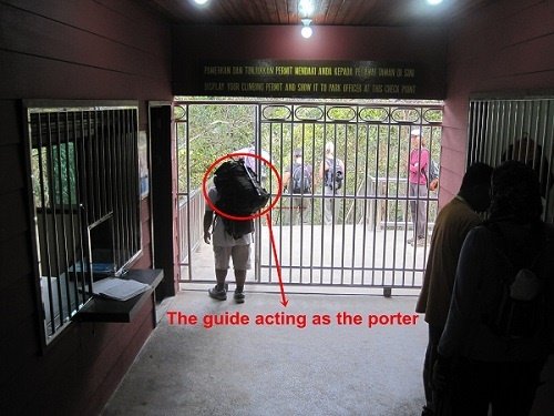
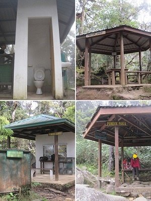
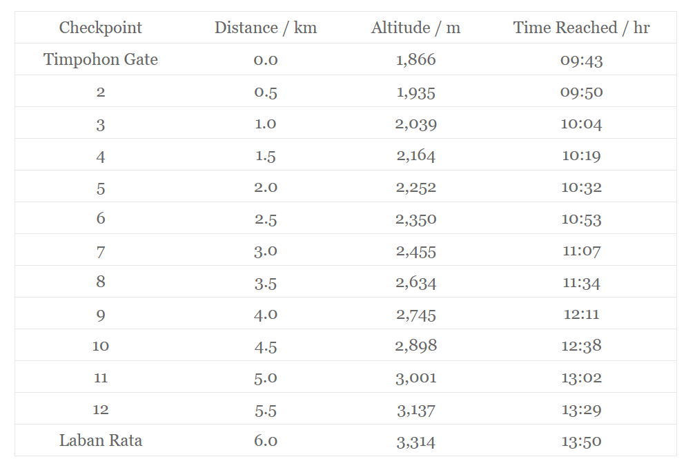
The distance from Timpohon Gate to Laban Rata is about 6 km. There is a shelter and a distance marker, which acts as a checkpoint, every 500m. Water points for drinking and washing, as well as toilets, are available at each shelter. The trail is generally very wide, well marked and well defined. Along the way, there are only a couple of split trails, and clear directional signs are available. It is almost impossible for anyone to get lost, which means you do not really need a guide to direct you up to Laban Rata. In fact, our guide was well behind us all the way, and we did not see him again until we reached Laban Rata. The trail is mostly rocky and dry (it is not muddy even when it rains) and is uphill all the way to Laban Rata.
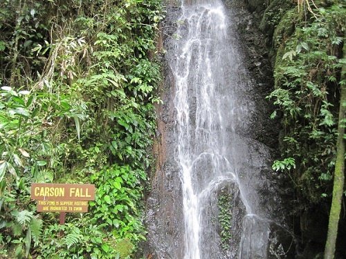
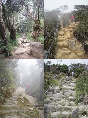
There is not much scenery along the way, as the trail is surrounded by tall vegetation on both sides. Animal sightings are not common, but we managed to see two hornbills and some squirrels. We were given packed lunches by our guide at the park HQ, which we carried in our daypacks. We stopped for a while for lunch at Layang Layang Shelter, about 4 km from Timpohon Gate.
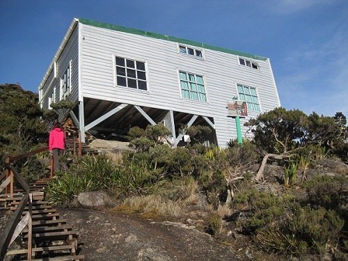
We reached Laban Rata (a.k.a. Laban Rata Resthouse) at 1.50pm after four hours of continuous uphill walking. Our dormitory – Penchant Hut – was another 100m uphill from Laban Rata Resthouse.
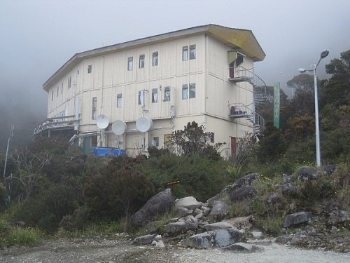
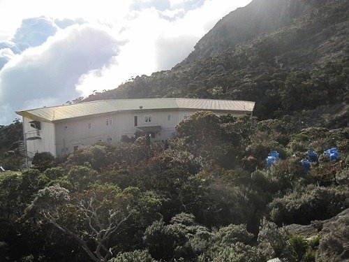
The table below shows our hiking progress from Timpohon Gate to Laban Rata:
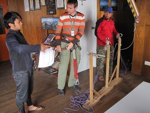
We signed up for Via Ferrata (Low’s Peak Circuit) with Mountain Torq. Climbers who signed up for the Ferrata activities were arranged to stay at Penchant Hut – a basic, non-heated dormitory without hot showers. All Ferrata participants had to attend a mandatory indoor pre-activity briefing session to familiarize themselves with the equipment and routes. After the briefing, we went down to the restaurant in Laban Rata Resthouse for a buffet dinner, which was part of the tour package. The buffet dinner was more of a marketing gimmick, considering that you would probably experience some loss of appetite due to the high altitude. For fear of taking a cold shower, we used wet tissues and prickly heat powder to clean ourselves before going to bed.
Day 3 – Summit Climb
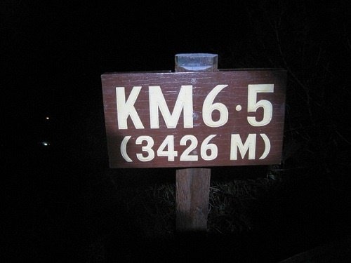
We woke up at 2.30am and embarked on the climb at 3.15am after a quick breakfast of toast and coffee. We had to climb with headlamps as it was very dark. It took us 45 mins to cover the first 500m and reach the 6.5 km mark, and another 55 mins to reach Sayat-Sayat, which is slightly beyond the 7 km mark. At Sayat-Sayat, there is a checkpoint where climbers are required to produce their climbing permits before being allowed to proceed further. We reached the summit at 6.25am, just after sunrise.
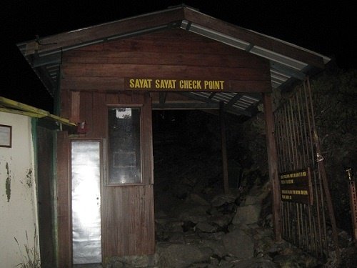
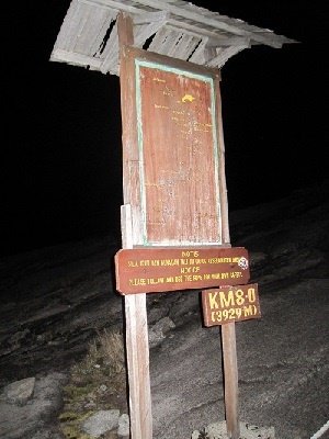
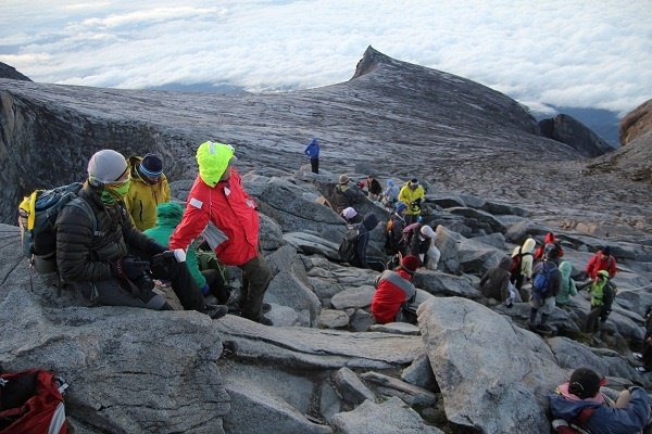
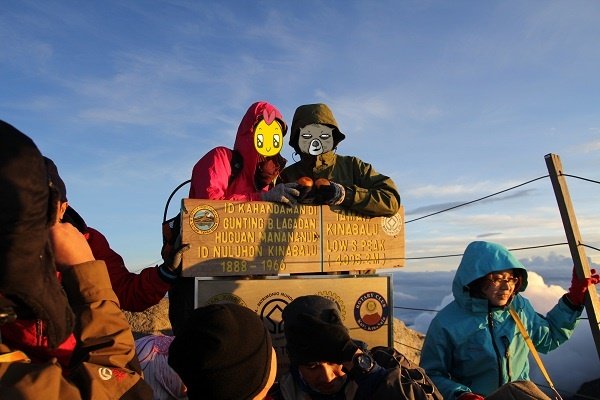
The distance from Laban Rata to the summit is about 2.7 km. The initial 700 metres consist of steep, rocky stairs and steps. The next 2 km are over large granite slab surfaces. The trail is marked by guide ropes, which can also be used as a form of climbing aid, all the way to the summit. By the time we reached the summit, it was already crowded with climbers. Most of the good spots were already occupied by climbers who had reached there before us. But we still managed to find a reasonably comfortable spot to sit down, rest and enjoy the scenery. The summit was so crowded that climbers had to queue up to take photos with the summit sign. We queued for 10 mins!
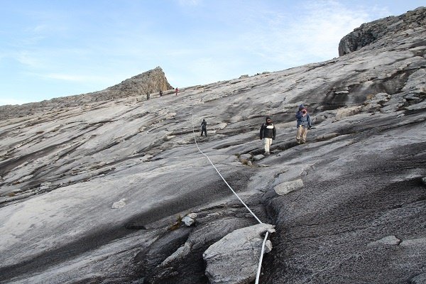
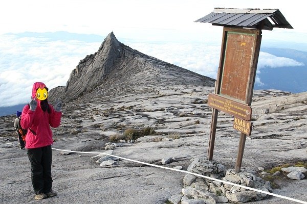
For climbers who did not sign up for Via Ferrata, the descent back to Laban Rata is via the same route they came up. As for Ferrata participants, the descent is via another route on the cliff side of the mountain. Ferrata participants have to reach the Ferrata trail starting point by 7.30am for Low’s Peak Circuit and 8am for Walk The Torq.
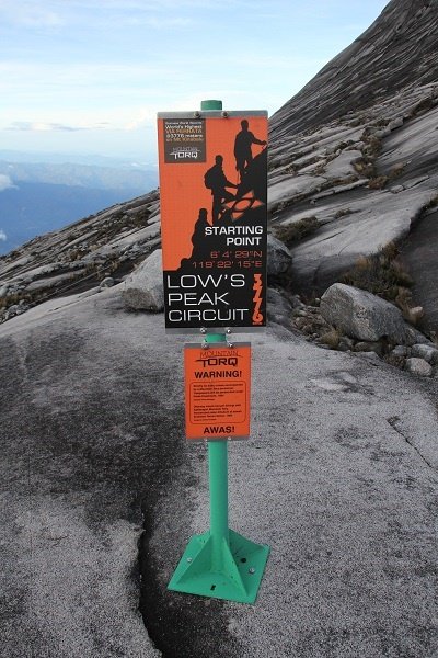
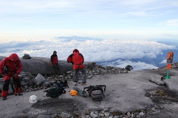
The whole length of Low’s Peak Circuit is 1.2 km, consisting of 600m of Ferrata route, 300m of forest trekking and another 300m of Ferrata route. Don’t be deceived by the short length of the circuit. We started the descent via Ferrata at 8.10am and reached the end of the circuit at 12.45pm, without much rest in between. It is a very strenuous activity, even for people who exercise regularly, as it works almost every muscle in your body. You have to pull yourself towards the cliff walls while balancing yourself against the steep slope. There are three “fear obstacles” along the way: a suspension bridge and a three-rope bridge before the forest trekking section, and a two-rope bridge after the forest trekking section.

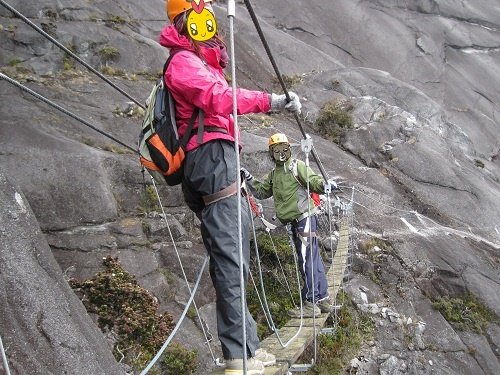
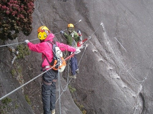
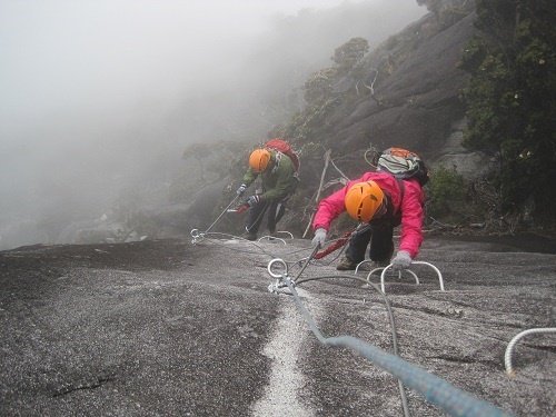
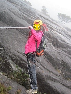
We were utterly exhausted, hungry and thirsty when we reached the circuit endpoint. Penchant Hut was still another 500m away. It was demoralizing to be reminded that we still needed to hike another 6 km before catching the bus back to Kota Kinabalu from the park HQ. We returned to Penchant Hut for some rest and refreshments before commencing the hike again. Our trek down was accompanied by incessant rain, which never stopped even after we reached Kota Kinabalu. Going downhill, though not as strenuous as going uphill, is more torturous, especially on the knees. We left Penchant Hut at 2pm and reached Timpohon Gate at 7pm.
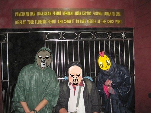
We were the last ones to leave the gate that day. The poor gatekeeper had to wait for us to arrive before closing the gate for the day. The minivan dropped us at the park HQ to collect the rest of our luggage and certificates (summit and Ferrata ^^), before sending us back to our hotel in Kota Kinabalu. They provided a packed dinner of fried rice with egg for us to eat in the minivan. We finally reached the hotel at around 10pm.
Leave a Reply