Syonan Jinja was a former Shinto shrine in the middle of the MacRitchie Reservoir forest. It was built by the Japanese Army and British prisoners-of-war during the Japanese Occupation of Singapore in World War II. It was officially unveiled on 10 September 1942. When the British forces re-occupied Singapore in 1945, the Shrine was destroyed. Today, only remnants of the Shrine foundation and pillars remain. In 2002, the Shrine site was declared a Historic Site by the National Heritage Board.
The shrine was built to commemorate the Japanese soldiers who died during the Malayan Campaign. A large tract of forest on the north-western side of MacRitchie Reservoir was cleared for its construction. Its design was based on that of the famous Yasukuni Shrine in Japan. Yasukuni Shrine serves as a memorial to more than two million soldiers who died fighting on behalf of the Emperor of Japan, from the Meiji era to World War II. Shinto, meaning “the way of the gods”, is the native faith of the Japanese and is primarily pantheistic. Its followers believe that divine spirits, or kami, reside in nature, which explains why Syonan Jinja was built in the midst of the forest.
(Reference article: http://infopedia.nl.sg/articles/SIP_236_2004-12-24.html)
Our starting point for the trek to Syonan Jinja was Venus Drive Car Park, located near the junction of Upper Thomson Road and Sin Ming Drive. For the first half of the trek, we followed the well-marked trail towards the HSBC TreeTop Walk. The second half involved leaving the marked trail and bashing through relatively thick vegetation to reach the shrine site.
There is a small stream beside the initial stretch of Venus Link. The stream is very shallow but quite clear and is teeming with small fish. The trail then enters the forest and continues for more than 1 km before emerging at the edge of the nature reserve. At this point, it runs parallel to Island Club Road, with the Singapore Island Country Club on the opposite side of the road. About 2.5 km from Venus Drive Car Park, the trail ends beside a bitumen road.
After walking approximately 300 m uphill along the bitumen road, we reached a fenced compound—the Bukit Kalang Service Reservoir. A narrow bitumen trail runs along the right-hand side of the reservoir and leads towards the TreeTop Walk. We followed this trail for about 200 m until we reached a T-junction. The trail on the right, Peirce Track, leads to the TreeTop Walk, while the one on the left, Terentang Trail, leads towards Syonan Jinja. However, there is not a single signboard in MacRitchie indicating the direction to Syonan Jinja.
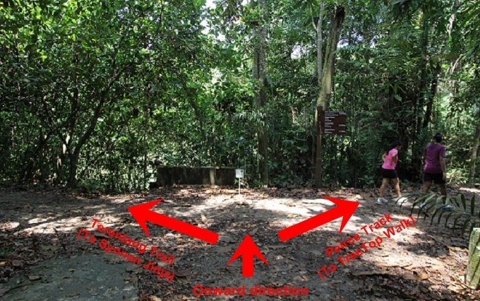
From online sources, we knew that Syonan Jinja could be reached via an abandoned forest trail that branches off Terentang Trail. The entrance to the forest trail is marked by three large boulders. We found this landmark after walking approximately 100 m along Terentang Trail. As you walk along the trail, look out for the boulders on your right.
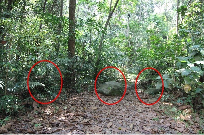
The forest trail was very well concealed by vegetation. From Terentang Trail, we could not tell that there was a side trail at all. Even after entering it, our view ahead was constantly obstructed by the dense vegetation. At times, the trail branched off in several directions. Fortunately, ribbons tied to the trees by previous explorers served as markers and helped us find our way. We frequently had to stoop beneath overhanging branches or climb over fallen logs.
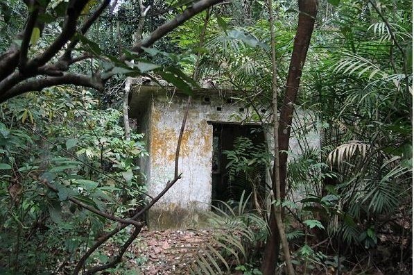
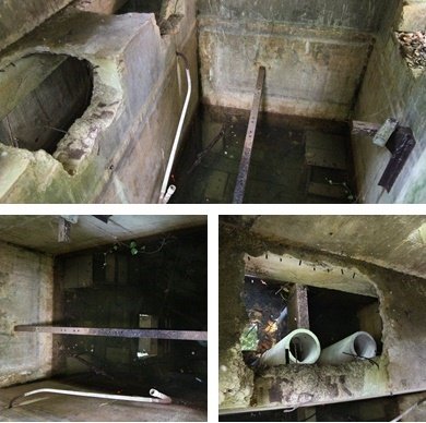
After about 30 minutes of bashing through the vegetation, we came across the first concrete structure. It was a small shelter with no floor. Inside it was an underground water compartment flooded to thigh level, with several plastic pipes inside. Surrounding the shelter were several waist-high, rectangular, tank-like structures. Perhaps the area was once a water-pumping station and the shelter housed the water pumps. We had no idea whether it had been built by the Japanese or by someone else.
Slightly farther along the trail, we came across four pillars arranged at equal intervals in a straight line. One had already fallen, while the other three were still standing. At this point, we could not see any trail other than the one from which we had come. We spent the next 15 minutes combing the area until we discovered a gently ascending trail that led westwards. Along this trail were several small rectangular concrete pits that resembled pillar foundations.
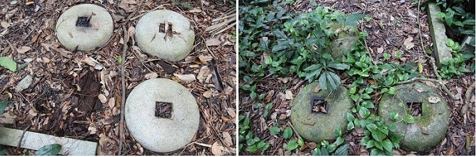
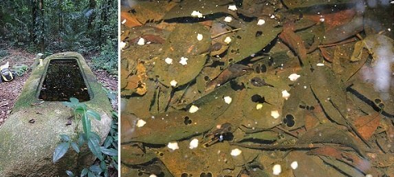
After following the trail for about 15 minutes, we emerged from the forest into an open space. Immediately in front of us was the shrine’s font. Measuring approximately 3 m by 0.5 m, it was filled with rainwater in which tadpoles were swimming. Positioned around the font were three circular concrete slabs, each with a square hole in the centre. These might have served as bases for supporting pillars.
At one edge of the open space stood a wall with a short flight of stairs leading to the top. However, there was not much to see up there.
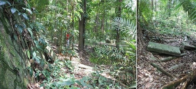
At the other edge of the open space was a long flight of stairs that ended at a trail running perpendicular to it and leading downhill. In the past, these stairs probably led to the main entrance of the shrine. We turned right onto the trail and trekked for another 10 minutes before reaching the waterfront. Along the way, we saw another small shelter resembling the one we had encountered earlier. This might have been another pump house.
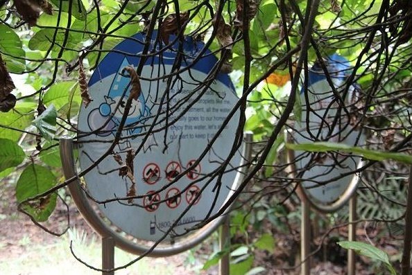
At the waterfront was a warning sign that read “Deep Water”. On the opposite side stood the Singapore Island Country Club, beside which ran a well-trodden route—Golf Link followed by Lornie Trail—that led directly back to the Nature Reserves Visitor Centre. It would have provided us with a short and easy return journey without having to backtrack or bash through the forest again. However, there was no easy way to cross to the opposite bank.
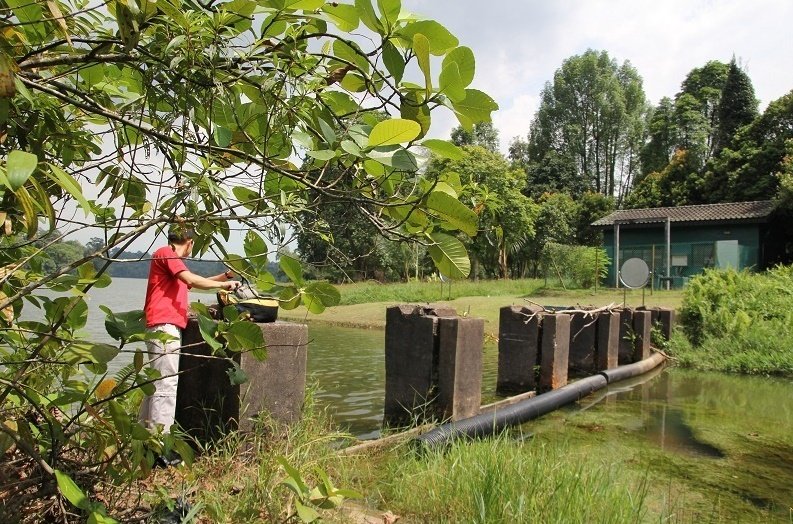
Beyond the warning sign was a tiny peninsula, with a swamp on its right and the waterfront on its left. Its tip was the point nearest the opposite bank. Between the two banks were six pillars protruding from the water, probably the remnants of an old structure. We spent more than 15 minutes racking our brains to find a way to cross the water using the pillars—it felt like an army situation test—but to no avail. In the end, we had to make the “painful” decision to trek back the way we had come. So near, yet so far!
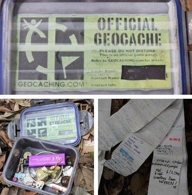
We found a geocache beneath the wall. It was concealed by a concrete slab leaning against the wall. We had learnt of its existence from a post on joyloh.com. The geocache consisted of a waterproof container holding several trinkets “donated” by previous geocachers who had found it. It also contained a stack of paper slips on which they could record their names and the dates of their visits.
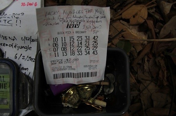
I remembered seeing some one-dollar coins in a photograph of the geocache on joyloh.com, but they were no longer there when we found it. We “donated” something that might once have been worth much more than a one-dollar coin—an expired Toto lottery ticket.
How to get there
The shortest route to the shrine site is most likely via Venus Link and Terentang Trail, followed by the forest trail that branches off Terentang Trail. This was the route we followed, and the round trip took us almost five hours. Some hikers started from the MacRitchie Reservoir Visitor Centre or Rifle Range Road, but their journeys took considerably longer.
Hiker Advice
The forest trail is poorly defined and densely overgrown with vegetation. It is advisable to carry a GPS device and a compass. The GPS coordinates of the shrine site are N 01° 20.900, E 103° 48.820.
I have heard of hikers who lost their way and wandered around in circles but still could not find the site. It is better to begin the trek in the morning rather than in the afternoon. That way, if you get lost, you will still have enough time to find your way back before sunset.
The forest trail is not maintained by the National Parks Board. There are many fallen logs and branches along the route. Beware of deadfall and falling branches, especially after rain.
Here are some essential items that you should bring for the trek:
- A GPS device and a compass (phone-based GPS may not be reliable because GPS reception can weaken under forest cover; a standalone GPS unit with strong reception is preferable)
- Sunscreen (you can still get sunburnt under forest cover)
- Mosquito repellent (you will regret it if you forget to bring some)
- At least one litre of water per person (we survived on only 500 ml each for five hours, but by the end, we were as thirsty as camels)
- Long trousers (I wore shorts and suffered numerous cuts on my legs from the vegetation)
- A raincoat (do not rely entirely on the weather forecast—or your own prediction)
- A sense of adventure