Mount Kerinci, located in the province of Jambi, is known for being the highest volcano in Indonesia and the highest peak on the island of Sumatra. It is surrounded by the lush forests of Kerinci Seblat National Park, home to endangered species such as the Sumatran tiger and Sumatran rhinoceros. Kerinci is also one of Indonesia’s most active volcanoes, with frequent eruptions. The mountain can be accessed from Kersik Tuo Village, about six to seven hours from Padang by car or bus. The climb to the summit and back normally takes about two days, with an overnight camp at one of the shelters. The area around Kerinci has numerous lakes, the largest being Lake Kerinci and Lake Gunung Tujuh. Lake Gunung Tujuh is also known as the Seven Mountains Lake, as it is surrounded by seven peaks. At 1,992 metres above sea level, it is reputed to be one of the highest crater lakes in Southeast Asia.
Day 1
We took a Tiger Airways night flight from Singapore to Padang. The one-hour flight departed Changi Airport at 8.55 pm and arrived at Minangkabau Airport at 8.55 pm Indonesia time. Our mountain guide and his driver picked us up from the airport in a private jeep and drove us to his homestay in Kersik Tuo Village.
We dozed off and woke up repeatedly throughout the seven-hour, bumpy and cold jeep journey. It was cold not because of the weather or the air-conditioning, but because the driver’s window was not completely wound up, allowing the chilly night air to blow through the gap into the cabin. We deduced that the jeep’s ventilation system might have been faulty and that the driver had to leave the window slightly open to let fresh air in. In hindsight, the ventilation system might have been perfectly fine and the driver was merely doing it out of habit. Whatever the reason, we suffered in silence because we were simply too embarrassed to ask him to close the window.
We finally reached the homestay in Kersik Tuo at around 4 am. We were assigned a room with a queen-sized bed and an attached bathroom. The bedroom had actually been partitioned off from the living room, while our guide and his family occupied the quarters behind it. Guests entered and left the house through the front door, while the family members generally used the back entrance. In a way, the living room acted as a privacy barrier between the guests and the family. My travel mate was not used to sharing a double bed, so he generously surrendered the entire bed to me and slept alone on the sofa in the living room. It was not such a bad deal for him, as the sofa was quite large and cushy.
Day 2

To catch the remaining few hours of sleep, we went straight to bed without filling our stomachs or taking a shower—although, for hygiene’s sake, we did brush our teeth. But at around 5 am, we were woken by prayers from a nearby mosque blasting through the loudspeakers. This was far more effective than our alarm clocks because there was no snooze button to hit. In the morning, our guide informed us that we would have to abandon the climb for the day because the weather near the summit was not favourable. He had received the information from a fellow mountain guide who had started the climb the previous day. We therefore postponed our ascent until the following morning and decided to visit Lake Gunung Tujuh instead.
Our guide hired a young man, whose name we unfortunately cannot remember, as a helper and mountain porter for the trip. Our main mode of transport during our stay in Kersik Tuo was the motorcycle—an economical and efficient way of manoeuvring through the narrow village roads. Of course, the real riders were our guide and his helpers. We merely sat pillion and enjoyed the scenery along the way.

The trailhead to Lake Gunung Tujuh was at Ulu Jernih Village, about 14km from Kersik Tuo. The ride there was quite scenic as we passed villages, tea plantations, padi fields and ponds along the way. We also saw groups of schoolchildren walking home by themselves. They were prancing around, teasing one another and generally looking carefree. It was quite a contrast to Singapore, where primary school children, often pulling their trolley school bags, are commonly accompanied by their maids or grandparents and sometimes look rather lethargic and disinterested after school.

A nominal conservation fee was payable at the small park office beside the trailhead. The roughly 6km hike from the trailhead, at about 1,400 metres above sea level, to the lake at 1,992 metres was relatively easy, except for the final section where some arm strength was required, particularly on the way back. We took about 2½ hours to reach the lake. We were moving fairly quickly with little rest, so hikers travelling at a more leisurely pace would probably take slightly over three hours. The trail climbed steadily all the way to the crater rim at around 2,112 metres, where we caught our first glimpse of the lake below. From the rim, the trail descended rather steeply for about 120 metres towards the lakeshore.

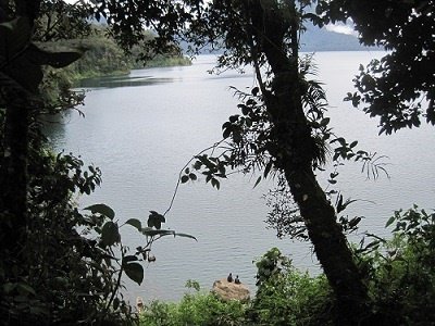
At the lake, we met a group of young Malaysian hikers who were on a university graduation trip to climb all the major mountains in Malaysia, Sumatra and Java. Hmm… definitely something interesting for them to put on their résumés. They had climbed Mount Kerinci a few days earlier and had spent a night camping beside the lake. There was also another group of local hikers fishing along the shore. We noticed two dugout canoes nearby. According to information we had read online, some locals staying around the lake could be hired to ferry hikers to the opposite side in these canoes. Think twice—the lake is several kilometres across and up to around 45 metres deep!

After visiting the lake, our guide brought us to Telun Berasap Waterfall, only a few kilometres from Kersik Tuo. The waterfall was easily accessible by car or motorcycle, with no hiking involved. A sheltered viewing platform offering a close-up view of the waterfall could be reached via a series of descending concrete steps. Although the waterfall, at around 50 metres high, was not exceptionally tall, its water flow was extremely powerful. The entire viewing area, including the shelter, was engulfed in a mist of spray that felt like rain. Do remember not to bring your camera down to the viewing platform unless it is properly waterproofed! The name Berasap is very appropriate, as berasap means “smoky” in Indonesian, and the huge amount of spray really did resemble smoke. We returned to the homestay afterwards for a bath and dinner. Unfortunately, the water was icy cold and there was no water heater in the guest bathroom.
Day 3
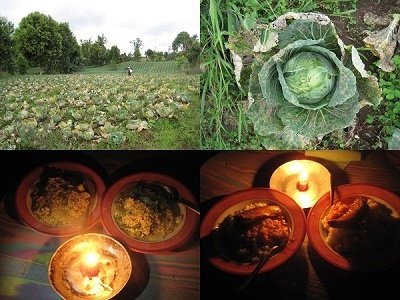
We woke up bright and early at 6.45 am the next morning to pack for the climb. After a breakfast of nasi lemak, we rode about 5km to the trailhead and started hiking at around 8.40 am. There were a few farms near the trailhead, where our guide picked up some potatoes and long beans for our dinner later that evening.


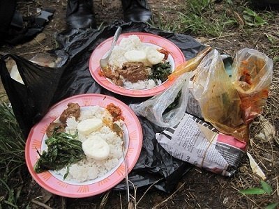
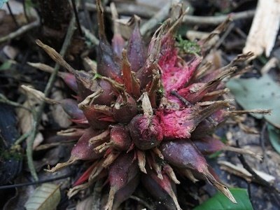
There were six main checkpoints between the trailhead and the summit: Pos 1, Pos 2, Pos 3, Shelter 1, Shelter 2 and Shelter 3. Our target for the day was Shelter 2, where we planned to camp for the night. Along the way, we stopped for lunch, which consisted of rice with tofu, egg, sambal, crackers and tempeh. It was simple fare, but having a packed lunch while climbing a mountain already felt like a form of luxury. Some of the interesting things we spotted along the trail included wild-boar footprints, hornbills, beetles, giant millipedes, cicada shells, wild orchids, wild ginger flowers and pitcher plants.

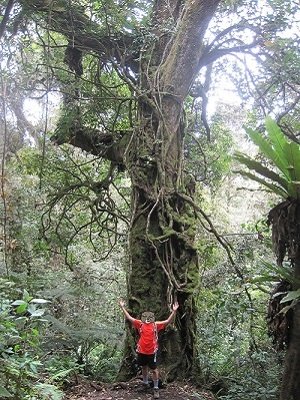
The trail was not particularly well marked, although the main route was fairly obvious despite a few branching paths. Fortunately for us, it had not rained during the previous two days; otherwise, we would have been trudging through thick mud. The climb from the trailhead to Shelter 2 was fairly straightforward, with a mostly moderate gradient. Beyond Shelter 2, however, the trail gradually became steeper, sandier and much more exposed to the wind. There had reportedly been fatal incidents involving climbers attempting the mountain without guides. It is therefore not a place to save a little money or try to be a hero—a knowledgeable local mountain guide is well worth engaging.

After more than six hours of climbing, we finally reached Shelter 2 at around 3.15 pm. According to our guide, most climbers took more than seven hours to get there. Hehe… we were considered pretty fast. There was a proper campsite with a concrete platform large enough to accommodate more than three two-person tents. However, it was very exposed to the elements and littered with rubbish. Instead, we set up our tent in a small clearing within the vegetation, where we were better sheltered from the wind.
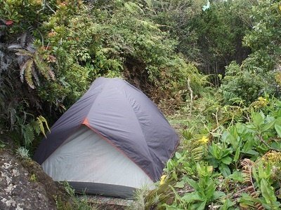
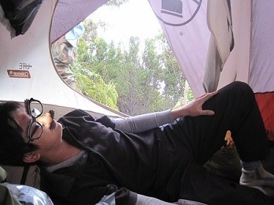
Unfortunately, the area around Shelter 2 was littered with rubbish left behind by previous campers. We even saw a rat scrambling around a heap of rubbish beside our tent. I still wondered how the rat had managed to make its way all the way up to around 2,800 metres. Dinner that evening was both sumptuous and romantic. Sumptuous because each of us had two main courses—instant noodles with vegetables followed by rice with sardines. Romantic because we ate by candlelight. Unfortunately, we were definitely in the wrong company for romance—two macho men sharing a candlelight dinner on a mountain!
The table below shows our arrival times and the altitudes recorded at the various checkpoints. Interestingly, my Casio barometric watch appeared to be much more accurate than my Garmin GPS when measuring altitude. The readings from the watch agreed more closely with the elevations shown on the signboards, whereas the GPS consistently gave higher values.
Day 4
We woke up at 2.30 am and resumed climbing at 3 am after a light snack of biscuits and tea. For me, the most challenging part of mountain climbing is not the seemingly endless steps, the cold wind or the slippery terrain. It is having to completely adjust your sleeping schedule—going to bed ridiculously early and then waking up in the middle of the night for the final push to the summit.
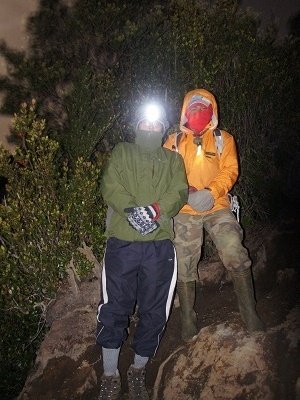
The first half of the summit trail followed a gully-like path surrounded by thick shrubs on both sides. The gullies were narrow but not particularly deep, and at times we had to walk along their raised edges, using the branches of the surrounding shrubs to pull ourselves up the slope. After climbing for about 1½ hours, we finally emerged above the shrub line into open terrain and were greeted by hundreds of village lights far beneath us and thousands of twinkling stars overhead. Beyond the vegetation, there were no more shrubs to grab onto—only rocks and boulders for support. At times, the wind was so strong that we had to lower our centre of gravity and scramble on all fours to keep ourselves steady. Whenever we looked upwards, all we could see were walls of volcanic rock and sand, with no sign of the summit. In fact, the summit only became visible during the final few hundred metres. It was almost like the carrot-and-stick approach—the goal was always somewhere ahead but remained hidden until the very end.
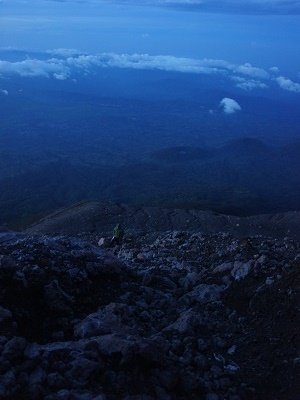
The highest point of Mount Kerinci lies along its crater rim, which was smoky and smelled strongly of sulphur. We took turns peering into the crater, cautiously bending our heads over the edge. It was quite a dangerous thing to do, as there was no safety barrier or fencing whatsoever. One wrong move and we might have become the volcano’s next human sacrifice. The enormous fuming crater, hundreds of metres wide and deep, looked awesomely intimidating, with red, glowing lava and ash visible on its floor. It looked large enough to swallow a few HDB blocks and still have plenty of room left. Lake Gunung Tujuh could also be seen in the distance from the summit.
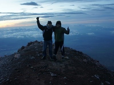
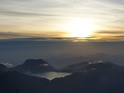

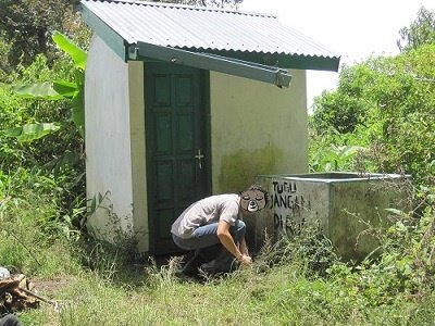
We spent less than 15 minutes at the summit before beginning our descent, as we did not want to linger too long around the narrow and exposed crater rim. Eventually, we made our way all the way back to the trailhead, where there was a small hut and a concrete basin filled with water. We washed the mud and dirt from our shoes while waiting for our motorcycle riders to take us back to the homestay.

After bathing, we had a simple lunch of gado-gado and took a much-needed nap. We woke up at around 5 pm for our final excursion before flying back to Singapore the following day. Our guide took us for a ride through the surrounding villages and padi fields before bringing us to a local restaurant for dinner—a relaxing end to our Mount Kerinci adventure.

